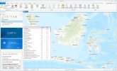
Description
ArcGIS Pro is the name of the engineering and specialized software in the field of geographic data analysis. In fact, the software in front of you allows you to integrate geographic information from multiple sources into a single program. On the other hand, this program is able to display your data in two-dimensional and three-dimensional spaces simultaneously. Thanks to the use of this software, you can manage and analyze multiple maps and layouts in a project-based workflow.
You can also edit your desired geographic data and information using ArcGIS Pro software. This software has also created a very wide interaction between engineers. You can share your geographic data with the world. On the other hand, you can receive data and information shared by other users. With the help of this software, you can best convert your geographic data into maps and practical information.
You can also create your designs in various standard formats and use dynamic capabilities such as presenting charts and tables. This software is also able to determine spatial relationships. On the other hand, with the help of this product, you can specify locations and routes based on various criteria.

Features and functions of ArcGIS Pro software:
Convert your geographic data and information into dynamic maps
Ability to integrate your data from multiple sources to achieve a single data
Display your data in the form of 2D and 3D maps
Ability to edit and analyze data depending on your project needs
Ability to share your maps and geographic data with the world
System requirements
Operating system
Windows 10 Home, Pro, and Enterprise (64 bit)
Windows 8.1 Pro and Enterprise (64 bit)
Windows Server 2019 Standard and Datacenter (64 bit)
Windows Server 2016 Standard and Datacenter (64 bit)
Windows Server 2012 R2 Standard and Datacenter (64 bit)
Windows Server 2012 Standard and Datacenter (64 bit)
Hardware requirements CPU
Minimum: 2 cores, simultaneous multithreading
Simultaneous multithreading, or hyperthreading, of CPUs typically features two threads per core. A multithreaded 2-core CPU will have four threads available for processing, while a multithreaded 6-core CPU will have 12 threads available for processing.
Recommended: 4 cores
Optimal: 10 cores
Storage
Minimum: 32 GB of free space
Recommended: 32 GB or more of free space on a solid-state drive (SSD)
Memory/RAM
Minimum: 8 GB
Recommended: 16 GB
Optimal: 32 GB or more
Dedicated (not shared) graphics memory
Recommended: 4 GB or more
If you're using a notebook computer with an integrated GPU, consider increasing the system RAM to compensate for the usage of shared memory.
Visualization cache
The temporary visualization cache for ArcGIS Pro can consume up to 32 GB of space, if available, in the user-selected location. By default, the visualization cache is written to the user profile's \Local subfolder, so it does not roam with the user profile if roaming profiles are enabled by your system administrator.
DirectX
Minimum: DirectX 11, feature level 11.0, Shader Model 5.0
OpenGL
Minimum: OpenGL 4.3 with the ARB_clip_control and EXT_texture_compression_s3tc extensions
Recommended: OpenGL 4.5 with the ARB_shader_draw_parameters, EXT_swap_control, EXT_texture_compression_s3tc, and EXT_texture_filter_anisotropic extensions
Screen resolution
1024x768 or higher
-------------------------------------------
ESRI ArcGIS Pro 3.4.2 Multilingual Full x64
Скрытое содержимое могут видеть только пользователи групп(ы): Premium, Местный, Свои
